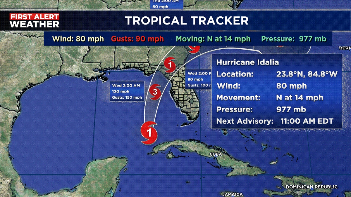
Hurricane Idalia is expected to make landfall on Florida’s northern Gulf Coast on Wednesday morning as a Category 3 storm. The worst impacts are predicted to occur in Florida’s Big Bend area, but the storm’s effects will extend hundreds of miles from the eye’s landfall. Multiple warnings including hurricane, tropical storm, storm surge, and flood watches have been issued across Florida, southeast Georgia, and coastal South Carolina.
City-Specific Forecasts:
- Tampa Bay: Under hurricane warning, with life-threatening storm surge, flooding, wind damage, and possible tornadoes expected Tuesday evening through Wednesday. Storm surge of 4 to 7 feet and general rainfall of 4 to 8 inches are anticipated.
- Tallahassee: Also under a hurricane warning, facing threats of flooding and destructive winds, potentially some tornadoes. A flood watch is in effect for 3 to 8 inches of rain.
- Sarasota: Under storm surge warning, tropical storm warning, and hurricane watch. Storm surge of 3 to 5 feet, and 3 to 6 inches of rain are expected.
- Gainesville: Under hurricane warning, major threats are strong winds and flooding rain, along with potential tornadoes. Forecast includes 3 to 6 inches of rain.
- Jacksonville: Under a tropical storm warning, expecting strong winds, flooding rain, and possible tornadoes. Forecast includes 1 to 3 inches of rain and a storm surge of 1 to 3 feet.
- Savannah: Under a tropical storm warning and storm surge watch, expecting strong winds, rainfall, and coastal flooding. A general 3 to 6 inches of rain and storm surge of 2 to 4 feet are expected.
The National Weather Service warns of potential building damages and widespread power outages where wind gusts are high. Flooding from rain and storm surges could lead to hazardous conditions and structural damages.
Officials urge preparation and evacuation where necessary. Changes in the storm’s path or intensity could alter these forecasts.
source: https://www.washingtonpost.com/weather/2023/08/29/hurricane-idalia-city-forecasts/